In search of the water glyph | Anasazi adventure with Quadman

Follow Quadman on his - Anasazi adventure
Anasazi adventure
Lost Spring Mesa has been on my bucket list since I first heard about a particular kind of Indian petroglyph called a water glyph. A quick search on the web increased my interest. More than 270 of these symbols have been found in an area of more than 2,000-square miles in the Arizona Strip. Bordering the states of Arizona, Nevada, and Utah, this area covers the entire known land occupied by the Anasazi Indians.
Research has shown that water glyphs were used by the Indians to indicate good camping spots with water. John Wesley Powell mentions in his journal that when he was exploring the land in the Arizona Strip he had employed a “very old Indian” as a guide. The Indian would go up on a butte or mesa. He could be seen searching the ground and scanning the horizon. Later he would indicate the direction they should go for water. Powell quipped that the guide was talking to the rocks when it is most likely that he was studying these glyphs.
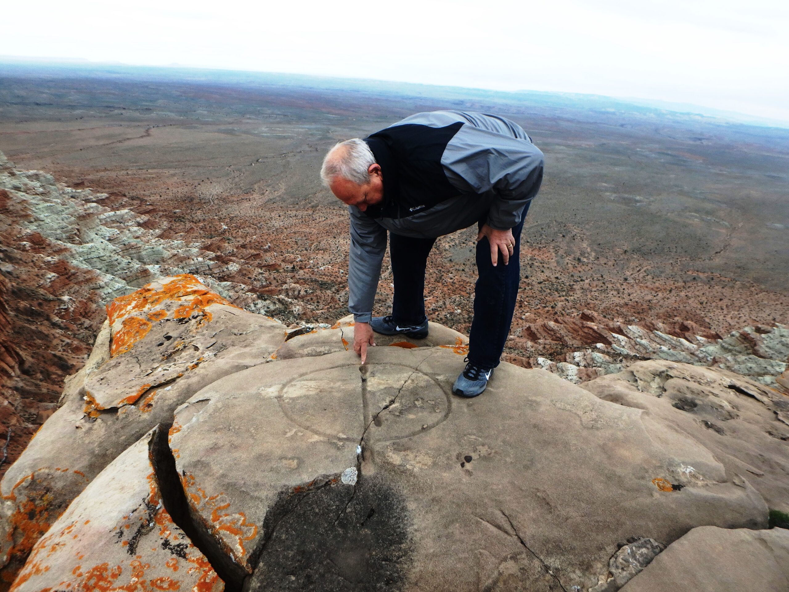
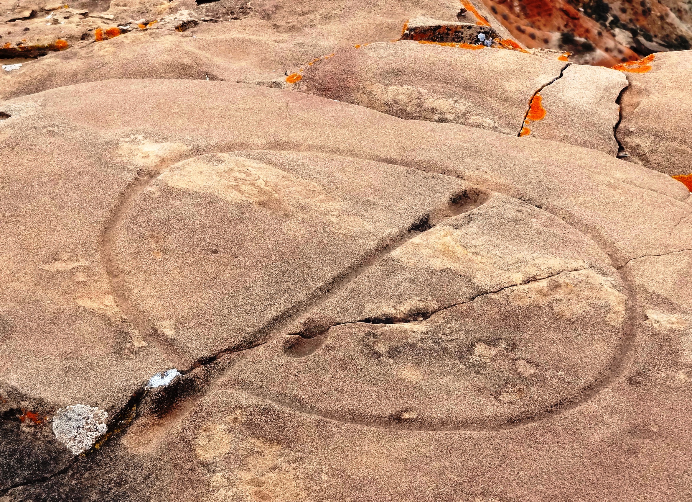
Unlike most petroglyphs, water glyphs are carved into the rock that is horizontal and on the ground. They are about 48 inches long by 24 inches wide and consist of a circle intersected by a directional line that extends beyond the circle. They include a dot inside the circle and sometimes another located on the outside. Carved almost an inch deep into the rock, they are usually found on the edge of a cliff.
Bill Kettler has more information on water glyphs on his web site www.southwestbackcountry.wordpress.com/water-glyphs. He describes the variety of glyphs that have been located and documented. Two amateur archeologists – Bob Ford and Dixon Spendlove, have spent a great deal of time locating, documenting, and mapping the direction the glyphs are pointing. Following the direction of the glyph would bring them to a water source, cache, or settlement where they would find more water glyphs that would take them in another direction.
These two were so sure of the meaning of the water glyphs that if they were to follow the directional line of one and didn’t find water or a good place to camp, they would not blame the glyph, but rather that something that had changed in the environment. They have found the water glyphs so dependable that they are still finding new sites by simply following these symbols through the desert.
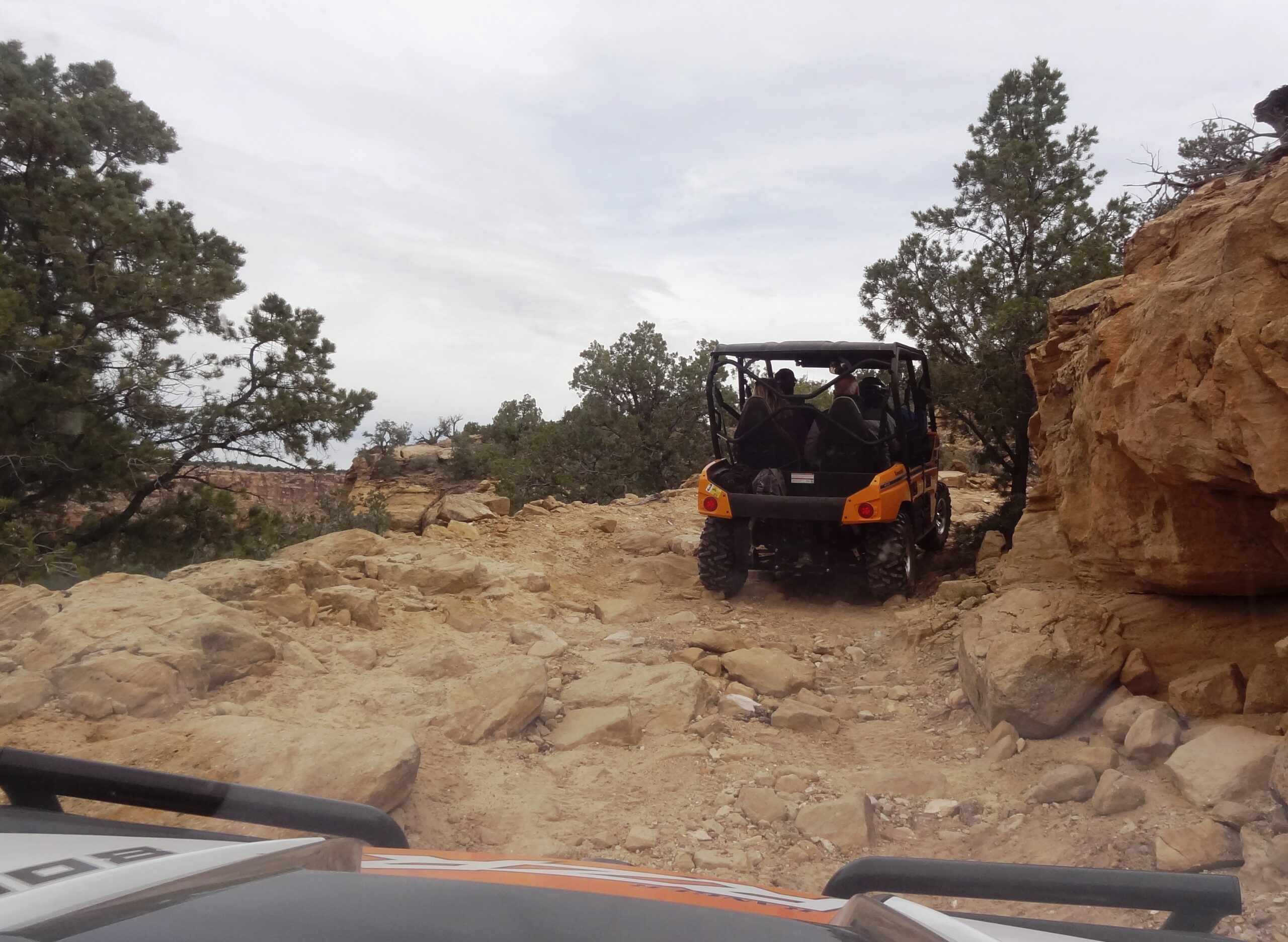
A friend of mine, Gus, who has been on Lost Spring Mesa where several of these glyphs are located agreed to show one to me. We loaded up a couple of UTVs and headed for the Arizona Strip.
Gus used to ride an ATV, but he gave that up for a side-by-side, which he gave up for the comfort of an airconditioned jeep. I think there is something wrong with this, but I haven’t been able to put my finger on it.
We turned off I-15 on the exit to Hurricane. Passing through town, we climbed the butte to the east and drove through Apple Valley. Just a little further down the road, we turned south where a sign on the left marked a housing development, Cedar Point.
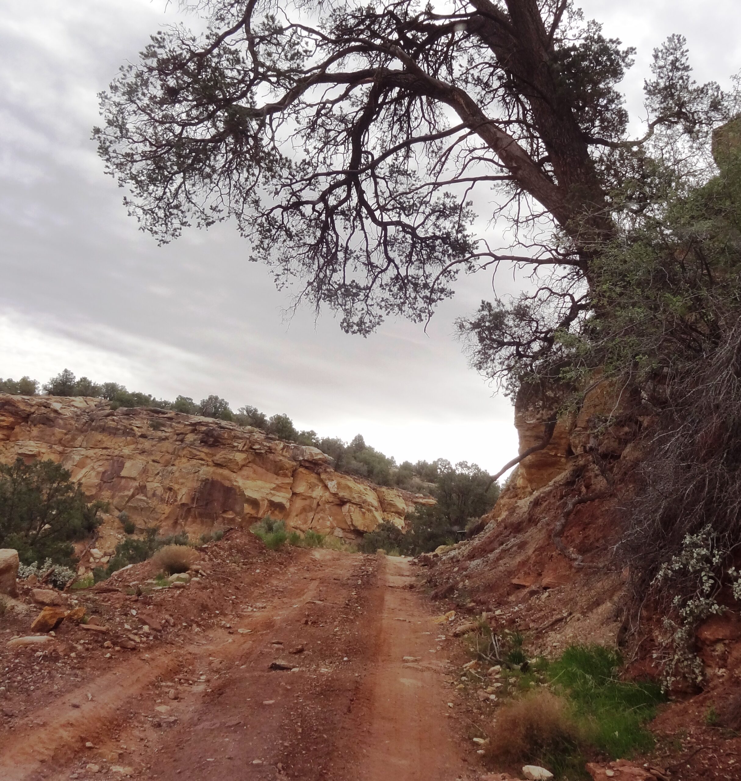
We unloaded shortly after the turn and began our ride. Following the jeep, we worked our way up a dugway on the west side of the mesa. The trail brought us around to the west edge of Lost Spring Mesa.
We were on the edge of the cliff and the view was amazing. We could see the Hurricane Sands off in the distance and Little Creek Mesa to the north. I looked down and there it was – a water glyph on the very edge of the cliff.
The experience was very special – a real connection with the past. It has more meaning to me than the other Indian rock art and now that I have seen this one I would like to find others.
When you go, take plenty of water, keep the rubber side down, and find a water glyph – it just might change the way you view the backcountry.