Kanab to Kamas on ATVs | Adventures with Quadman

Day 1
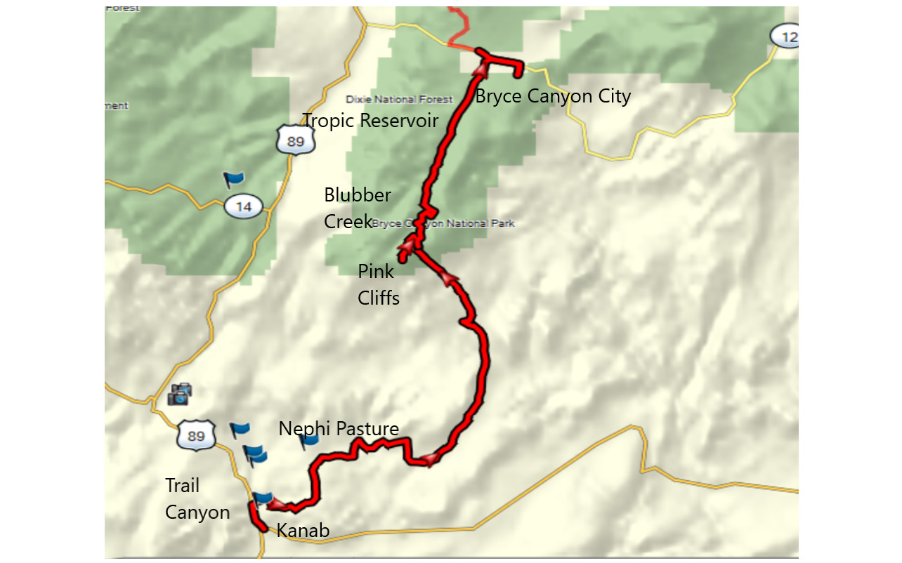
Riding an ATV from the northern border to the southern border of Utah has been done before. It takes six days to do it sensibly if you can make sense of it. We were going from the south to the north and we only had five days available so we decided to begin in Kanab and end in Kamas.
Choosing a time to go was a challenge. Sections of the trail reach almost 11,000 feet. It takes snow a while to melt up there. Fires have also closed sections of this trail in the past.
We chose to leave Kanab on the 29th of June. Drivers took our rigs back north to have them ready for us in Kamas on the following Friday. It was an eerie feeling watching those taillights leave Kanab that night before, realizing we were now committed.
Hotel reservations were made along the route and our machines were street-legal, knowing we would need to ride some highway to connect routes. I had ridden each section of the trail so I had GPS tracks to follow.
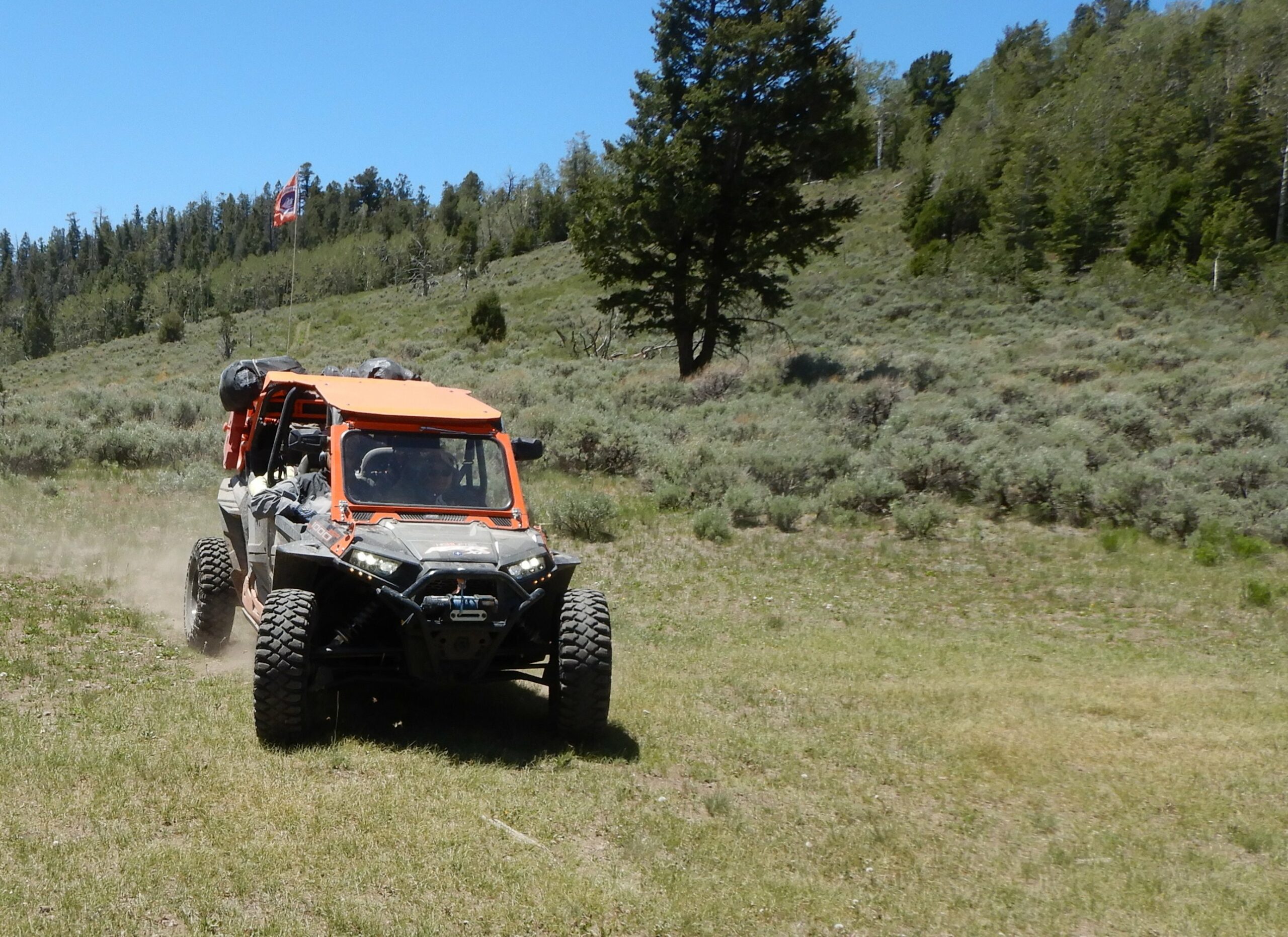
We were 16 people on four ATVs and three UTVs, escorted out of town by a cool morning breeze with no rain in the forecast. We couldn’t ask for better weather.
After a short sprint on Highway 89, we turned west into Trail Canyon and followed Kanab Creek. Working our way through the willows in the creek bottoms, we came to an ATV bridge that took us across a wide section of the creek. Our widest machine was 64 inches so we easily made the crossing.
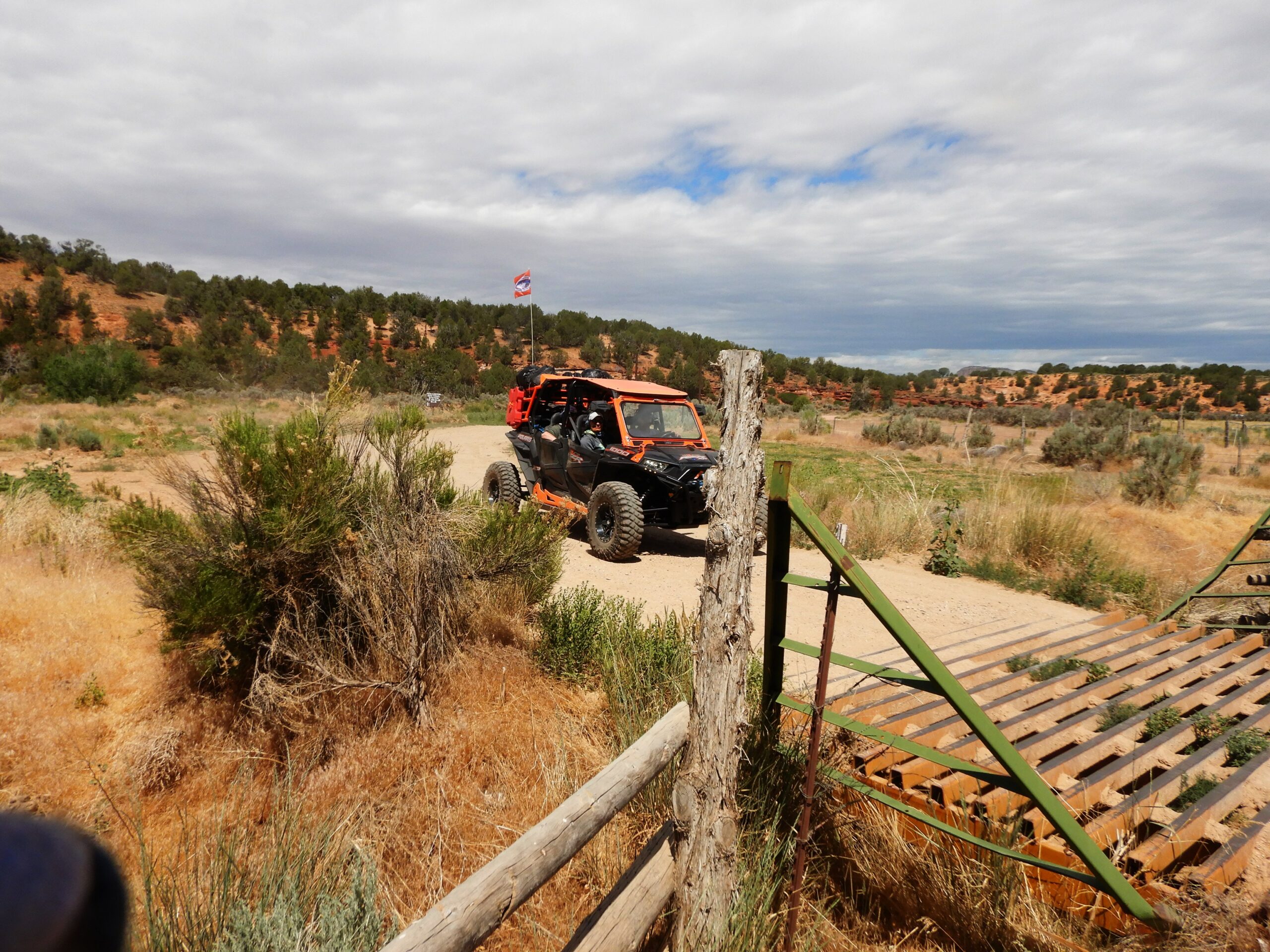

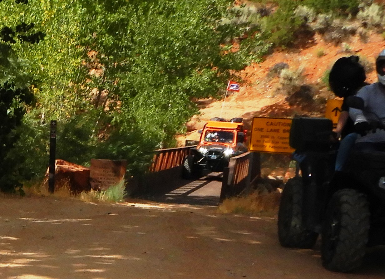
Passing back over the highway, we traveled east onto the Hog Canyon Trails. These are true desert trails – sandy, dotted with yucca and prickly pear cactus, sagebrush, and juniper trees. The trail was quite calm until we reached the entrance to the Mosdell section of the Hog Canyon Trails.
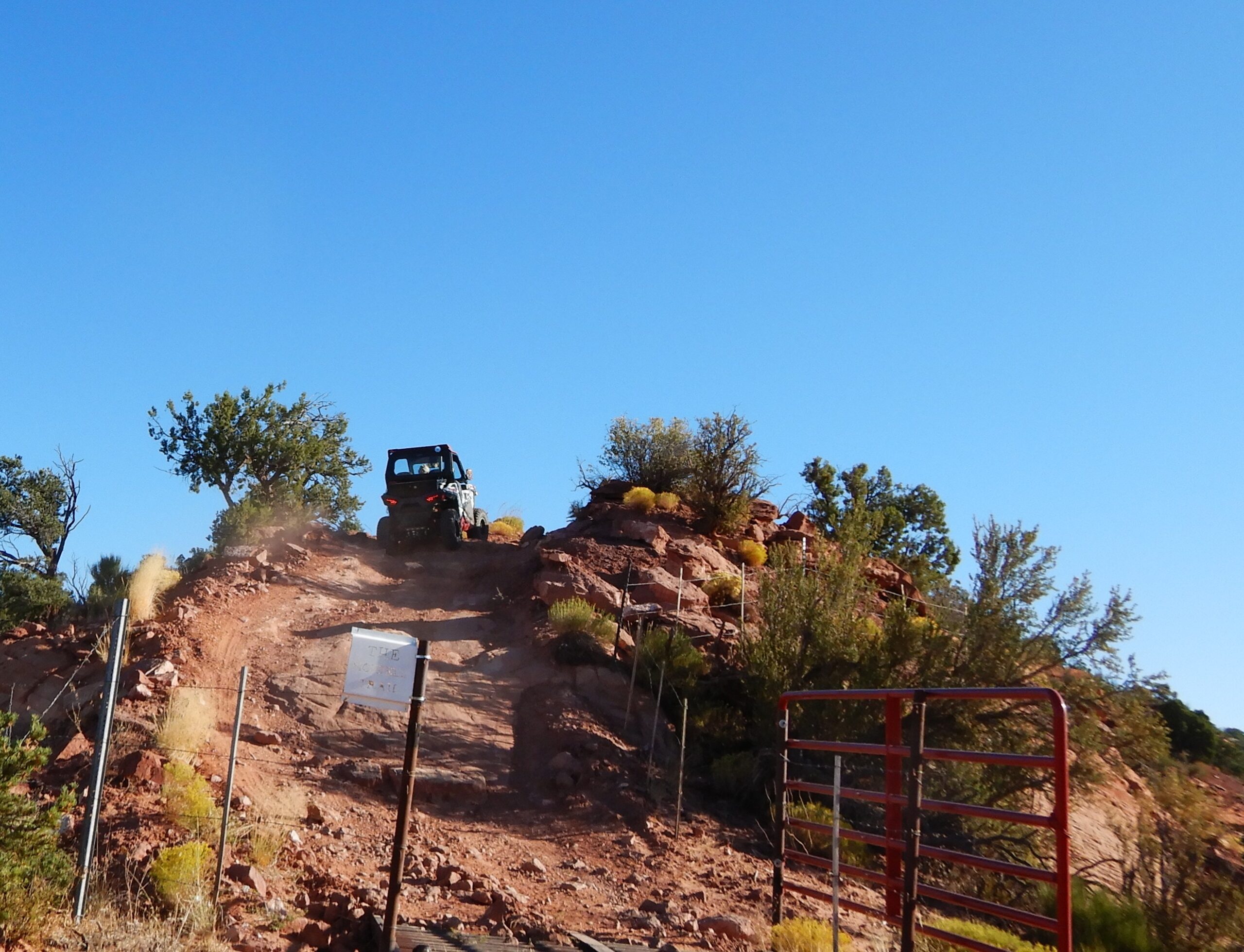
I was riding with Steve Lindsay of Bountiful in a Polaris 4 900 so I didn’t have to pick the line in climbing this first steep scramble. He did well and the machine-made it easily to the top. It wasn’t the last of the Moab-type challenges we encountered, there were several more and we successfully clambered up them all.
We came out on the east side of this trail system at the Crocodile Staging area. Turning north on the Johnson Canyon road, we traveled about a mile and a half before we turned off into Nephi Pasture. This section of trail was characterized by colorful buttes stained with reds, whites, and tans with sheer walls rising hundreds of feet from the valley floors.
We dipped down into Snake Canyon and while we didn’t see any, we did see a lot of lizards. Like the Count on Sesame Street, we love to count lizards. We counted 25, ha-ha-ha!.
We passed Timber Mountain and dipped into Adam’s Wash before we turned onto the Deer Springs Road and stopped for lunch in Meadow Canyon. These stops are great social events. We had a rider from Louisiana, five from Utah, and ten from Arizona. We sat around chewing on cherry twizzles bragging about who had the biggest tires.
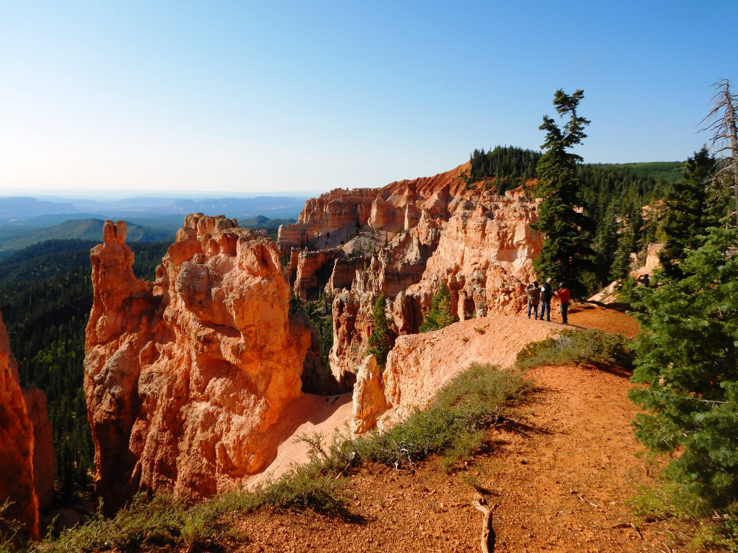
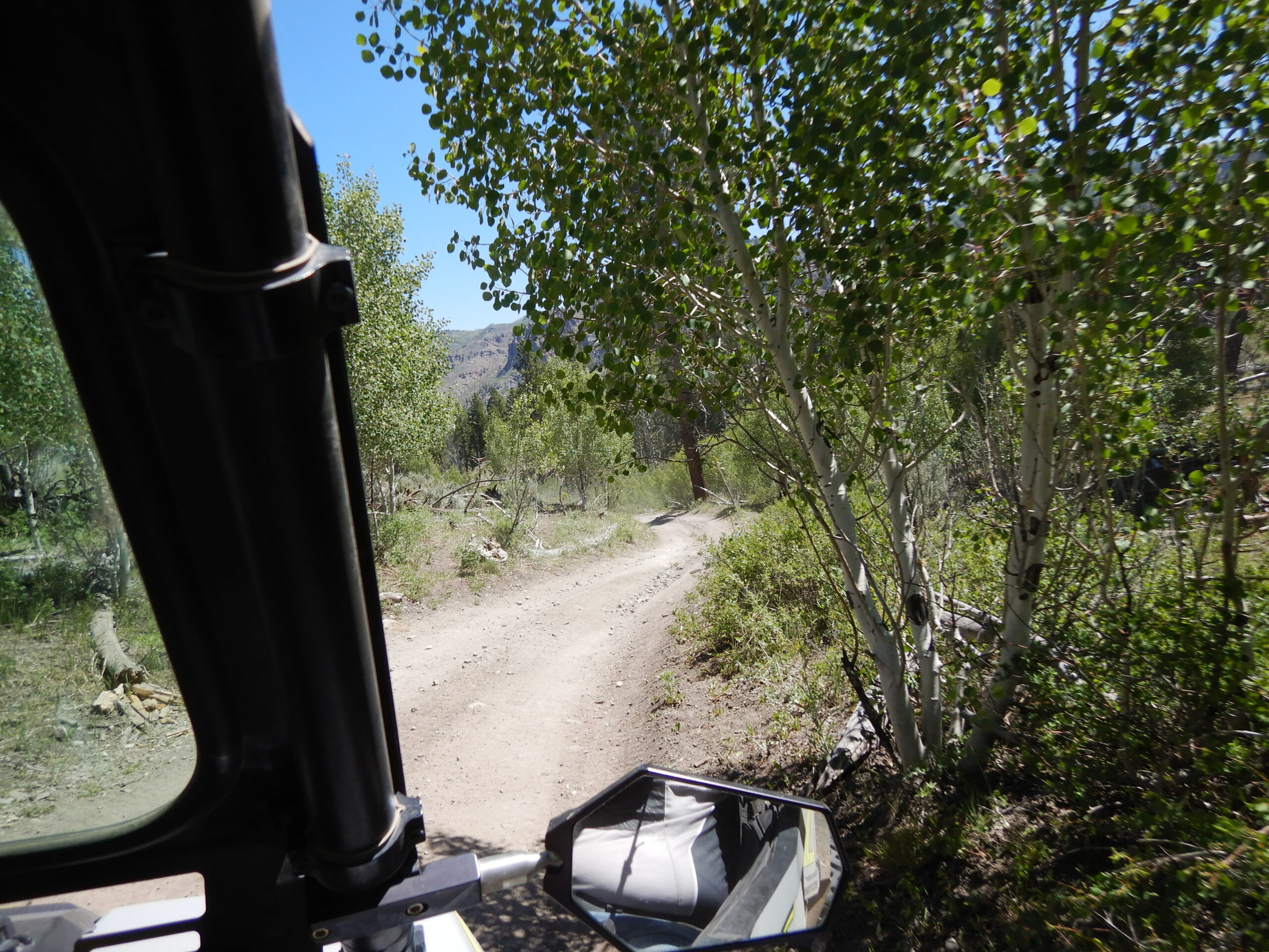
Lunch over, we entered Crawford Canyon and climbed to Crawford Pass where there is a nice rest area. We took time for a nine-mile trip to the Pink Cliffs and a viewpoint that allowed us to look back along the trail we had ridden. We could see it for miles and miles. It was an amazing view.
Leaving Crawford Pass, we picked up the trail alongside Crawford Creek and then into Coyote Hollow where we followed Podunk Creek. I think it is fun to know that there is a Podunk Creek and that I didn’t make it up. If that wasn’t fun enough, we found a Blubber Creek and later turned our nose up at Skunk Creek.
As we approached the east side of the Tropic Reservoir, we came to Tropic Spring. This is a fenced area that has a little rock structure with a spout on top that was constantly running cool, clear, spring water. It was a delightfully refreshing place to stop.
Continuing past Tropic Reservoir, we came to Highway 12 where we found gas and went to the Bryce Canyon Pines for our first night. The first leg of our trip was 103 miles. When you go take plenty of water, keep the rubber side down, and see what you won’t see unless you get off the highway.
Day 2
The altitude at the Bryce Canyon Pines Motel is 7,700 feet. The temperature outside our rooms when we walked outside was 33 degrees. One of our riders splashed water on his windshield to clean it and it turned to ice instantly. That was enough reason to go to the motel’s restaurant and let things warm up a little before we started our second day on the trail to Kamas.
The northern part of the trail that took us to Bryce Canyon is on the Paunsaugunt ATV Trail System. Trails on this system offer amazing views on the edge of the cliffs (outside the park) for which Bryce Canyon is famous.
Dressed for the weather, we headed west on Highway 12, passing Lightning Draw. Before entering Red Canyon, we turned north on Tom’s Best Spring Road, which is the beginning of the Fremont ATV Trail, the connector trail between Bryce Canyon and Circleville at the southern edge of the Paiute ATV Trail System.
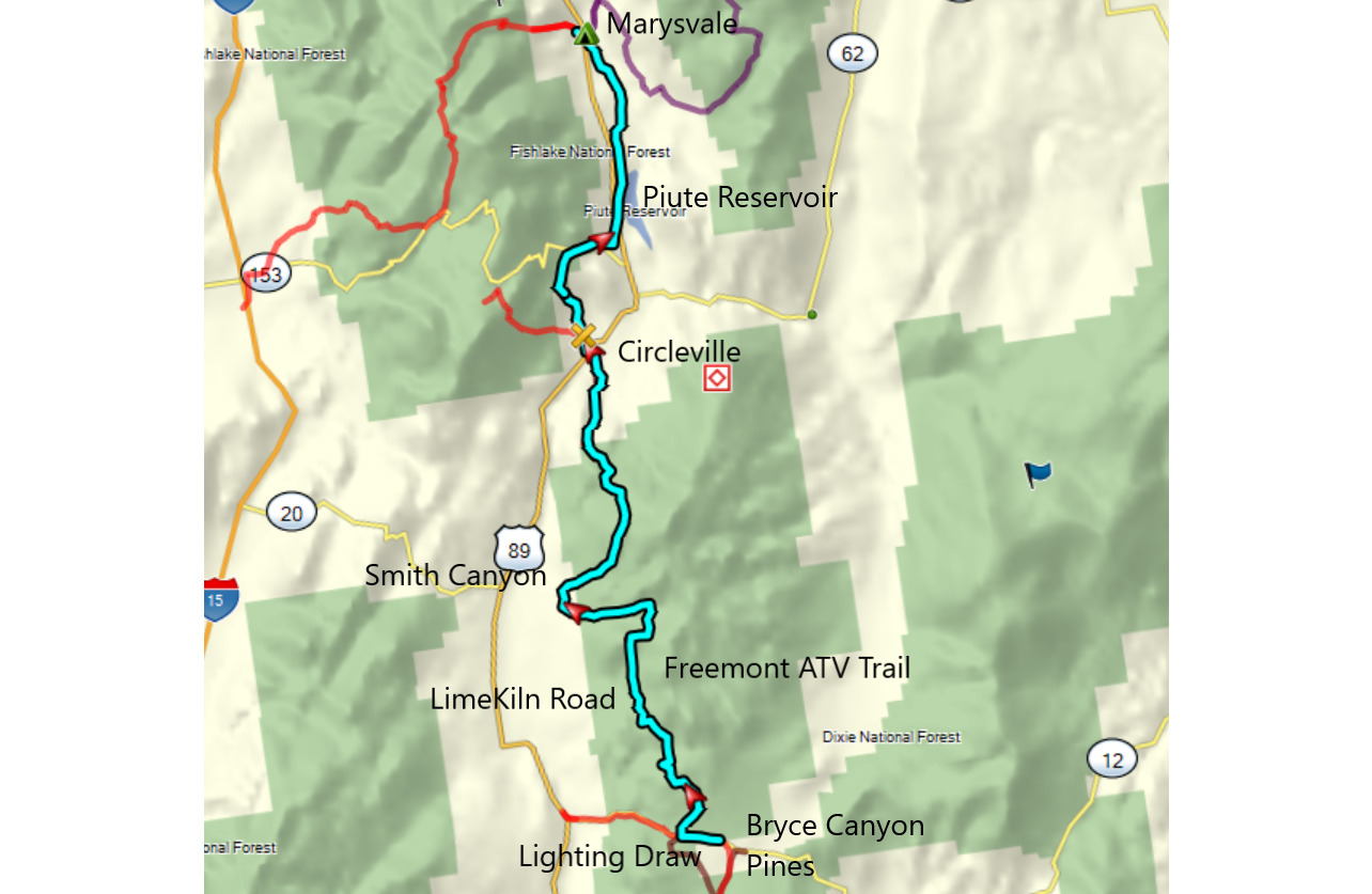
We soon picked up the Limekiln Road and noticed a change in scenery. This trail winds through tall ponderosa pines standing in blankets of manzanita brush. I was interested to learn that Native Americans used manzanita for a variety of medicinal purposes and for food.
We became more comfortable as the temperature climbed. There wasn’t a cloud in the sky, which showed an indigo blue through the pines. This deep blue was in contrast to the red bark of the ponderosa pines, the green leaves, and the smooth orange, twisted branches of the manzanita all against the backdrop of the stark, ashen gray of the Limekiln Road. This section of the trail twists through a leaden landscape of eroded hills that was nothing like the reds and whites we had left in Bryce Canyon.
The Limekiln Road turned west and we picked up the Seeds Lake Road. Once past the Seeds Lakes, we turned west down Sanford Canyon and out of the Dixie National Forest.
Turning north and then east we reentered the forest up Smith Canyon and noticed another change of scenery. The canyon floor was covered with sagebrush, but rising out of the valley floor were sharp, rugged, rock formations in a variety of shapes that towered high above us as we coiled our way around them. We climbed out of the canyon and stopped for a break at the top of the pass.
Realizing that we hadn’t lost anyone, we continued north. Dropping out of the mountains, we crossed the valley floor into Circleville. I learned that the town got its name from Circle Valley in which it is situated. It is surrounded by mountains except where the Sevier River enters and exits the valley.
We stopped for lunch at the Butch Cassidy Café. You may not think that a town of 547 people would have much to offer for lunch. This little place is a jewel of the trail. Not only were the sandwiches good, but the pastries were also great.
Leaving this little oasis, we headed for trouble. We didn’t know it at the time, but it was what it was. We kept to the valley to shorten our ride to Marysvale.
We had ridden past the Piute Reservoir when one of the machines threw a drive belt. It was an older 2007 Polaris Touring 800 and when the belt broke, it wrapped around the secondary clutch. Fortunately, we were within ten miles of Marysvale so we towed it into town, but because the secondary clutch was engaged, it was a slow tow.
We checked into our cabins at the Rocky Ridge Resort and set about solving our mechanical problems. Where were we going to get help in this small town of 408?
The answer came from the Rose Ranch RV Park north of town. The word was that Jim Townsend (JT) knew his way around an ATV. We had to smile as we listened to him talk, “Now, I charge $25 per hour,” he said. “So if it takes two hours, you owe me $50.” We were thinking to ourselves that we need to bring our machines to him. His charges are a fraction of those in the big city.
We called Jorganson’s in Richfield and purchased a belt. They agreed to hang it on the fence because they were closing. We sent a rider to pick it up and we were back in business – whew! When you go, take plenty of water, keep the rubber side down, and stay tuned for day three.
Day 3
Our stay at the Rocky Ridge Resort in Marysvale was restful and pleasant. We had traveled 193 miles in two days, the drive belt was replaced on the Polaris, and we were ready to go. There was not a single place to eat that was open this early.
That turned out to be the least of our worries. Six of our seven machines fired up to begin day three and one didn’t. This time it was a 2008 Polaris Sportsman 800 so out comes the tow rope. We were going back to Rose Ranch for more of Joe’s magic.
We were not disappointed. Joe found the problem – a solenoid on the starter was bad. Once again we called Jorgensen’s in Richfield. They had the right part and Joe gave us a lecture about what our predicament might be if we turned off the machine before we got to Richfield. We adjusted our route to get that fix.
With our fun-o-meters set on anxious, we pulled out of Marysvale to the east and then headed north. This route was not as pretty as our original route, but we were on a mission.
We climbed over the Antelope Range by an old mining operation and followed switchbacks that took us down 2,100 feet through Long Valley into the little town of Joseph – population 344.
We had problems with our leader who made two wrong turns before someone found the right trail to Elsinore. Unfortunately, I was the leader. Fortunately, everyone was still following me.
We passed through Graveyard Hollow and picked up a trail that followed the Sevier Valley Canal on the way to Elsinore. The lazy flow of the brown canal water was hardly noticed. All eyes were on Allen who was riding the Sportsman with the bad solenoid. We were all ready to pounce on him if he even touched the ignition switch.
Elsinore is a little pioneer town with a population of 847. We passed through unceremoniously and soon found ourselves in Richfield, population 7908 – big enough to have a Walmart.
Jorgensen’s auto broker was not too hard to find. It was right next to the Jorgensen’s Bowling Center which was right next to the Jorgensen’s Ford Dealership. We dined on bowling center cuisine while Allen’s machine was being fixed.
Tummies full and all seven machines running, we left Richfield headed for Aurora. Our trail followed the Piute Canal and I-70 ironically on Trail #70.
Aurora, population 1049, got its name from the occasional appearance of the Northern Lights in the night sky. Moving through Salina, population 2,564, we learned that the name comes from the abundant salt deposits nearby. If you have ever used salt with a pink color called, “Real Salt,” it came from Redmond, Utah, just north of town.
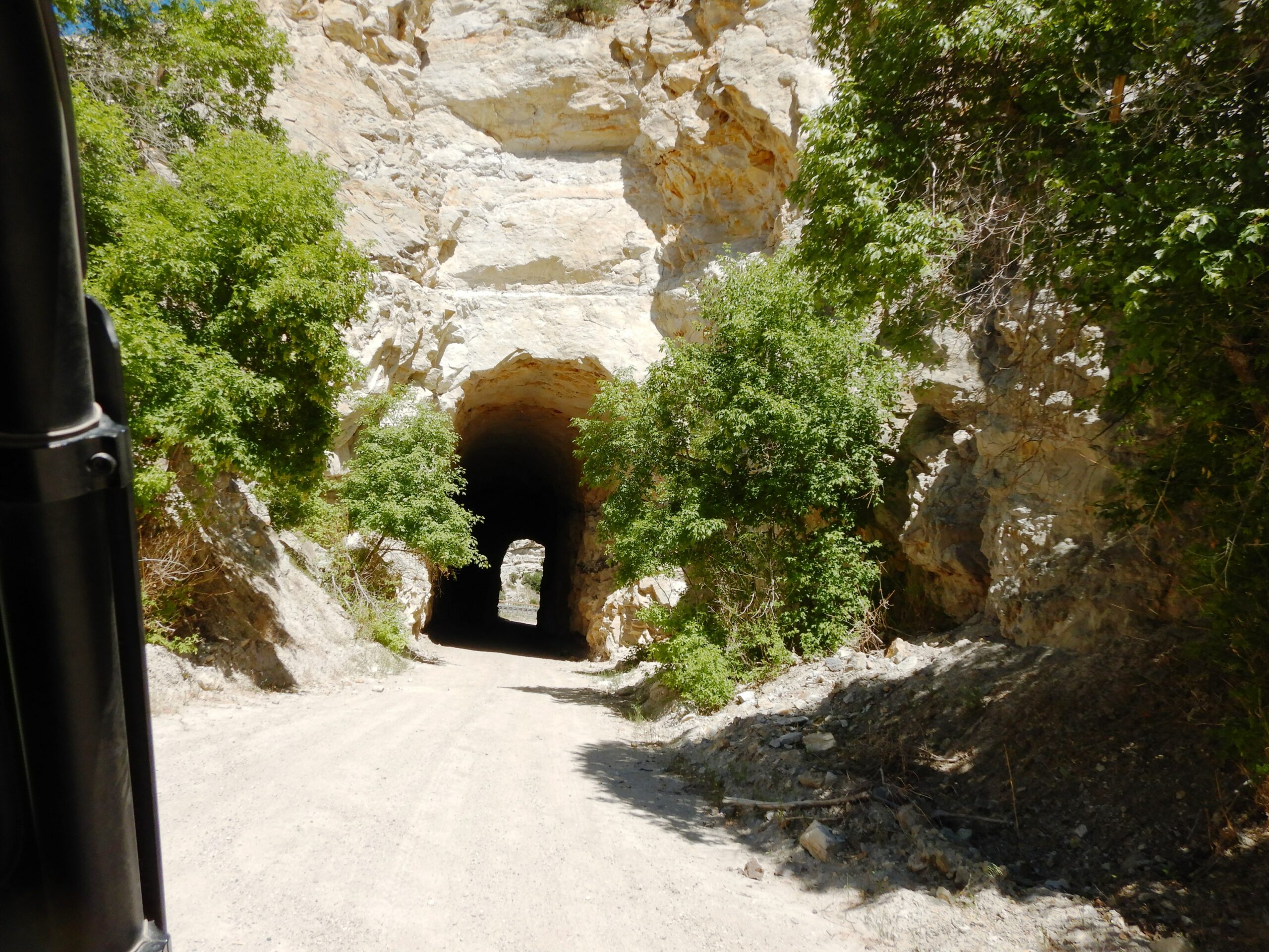
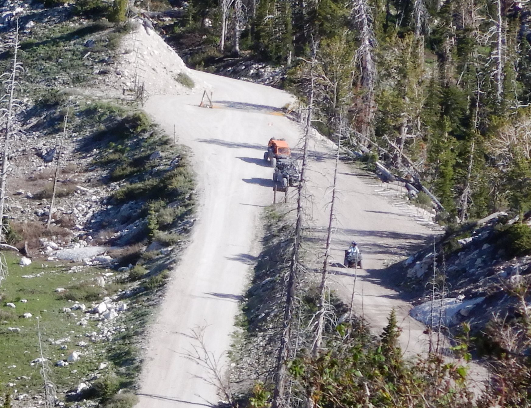
Leaving Salina, we were back on the track we had originally planned and headed for the high country. The trail followed I-70 on a frontage road that used to carry railroad traffic. We passed through two long railway tunnels before climbing up Salina Canyon to the Skyline Trail.
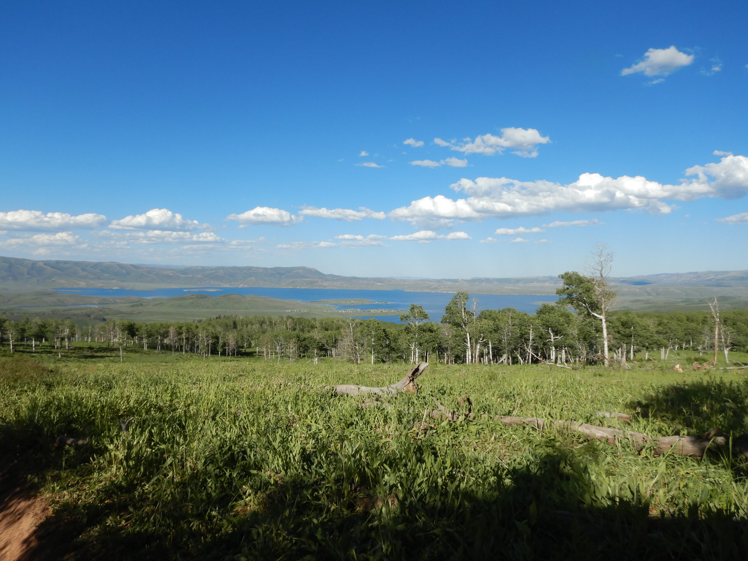
By the time we reached the head of Salina Creek, we had crossed the 10,000-foot point in elevation. The Skyline Trail goes for some 58 miles without dropping below 10,000 feet and the views are amazing. Needles were starting to bend as they banged against the “Wow” peg on the fun-o-meters.
The Skyline Trail is a part of the Arapeen ATV Trail System. On the Arapeen Trail Map, there are over 50 GPS coordinates for prime fishing spots.
We were passing them on the trail – Blue Lake,
Henningson Reservoir, Island Lake, and Emerald Lake, but the fishing wasn’t on our agenda this trip.
We passed all of these before coming to 12 Mile Campground, a quiet Forest Service Campground situated above 10,000 feet. From there we began our climb to “High Top,” the peak of the Skyline Trail where we stopped for a Kodak moment. A sign marked the altitude here at 10,897 feet.
We could see another fishing spot to the east, Duck Fork Reservoir and we had just passed Ferron
Reservoir. We were almost giddy being on a trail this high surrounded by such beauty.
We soon made our way to the junction that took us down to Ephraim finishing the third day of our ride – 140 miles. We stayed at the Willow Creek Inn and dined on Chinese take-out. When you go take plenty of water, keep the rubber side down, find your high on the Skyline Trail.

Day 4
With 331 miles behind us, we were ready to tackle the challenges of day four on the trail to Kamas. We had no idea what those might be, but our trailers were waiting for us in Kamas and we had to figure out how to get there.
Leaving the Willow Creek Inn in Ephraim, we climbed back up to the Skyline Trail. The weather was perfect and we were back up above 10,000 feet on “top of the world looking down on creation.” There is something truly amazing about being that high with nothing above you. On a day like this day, we could see for miles

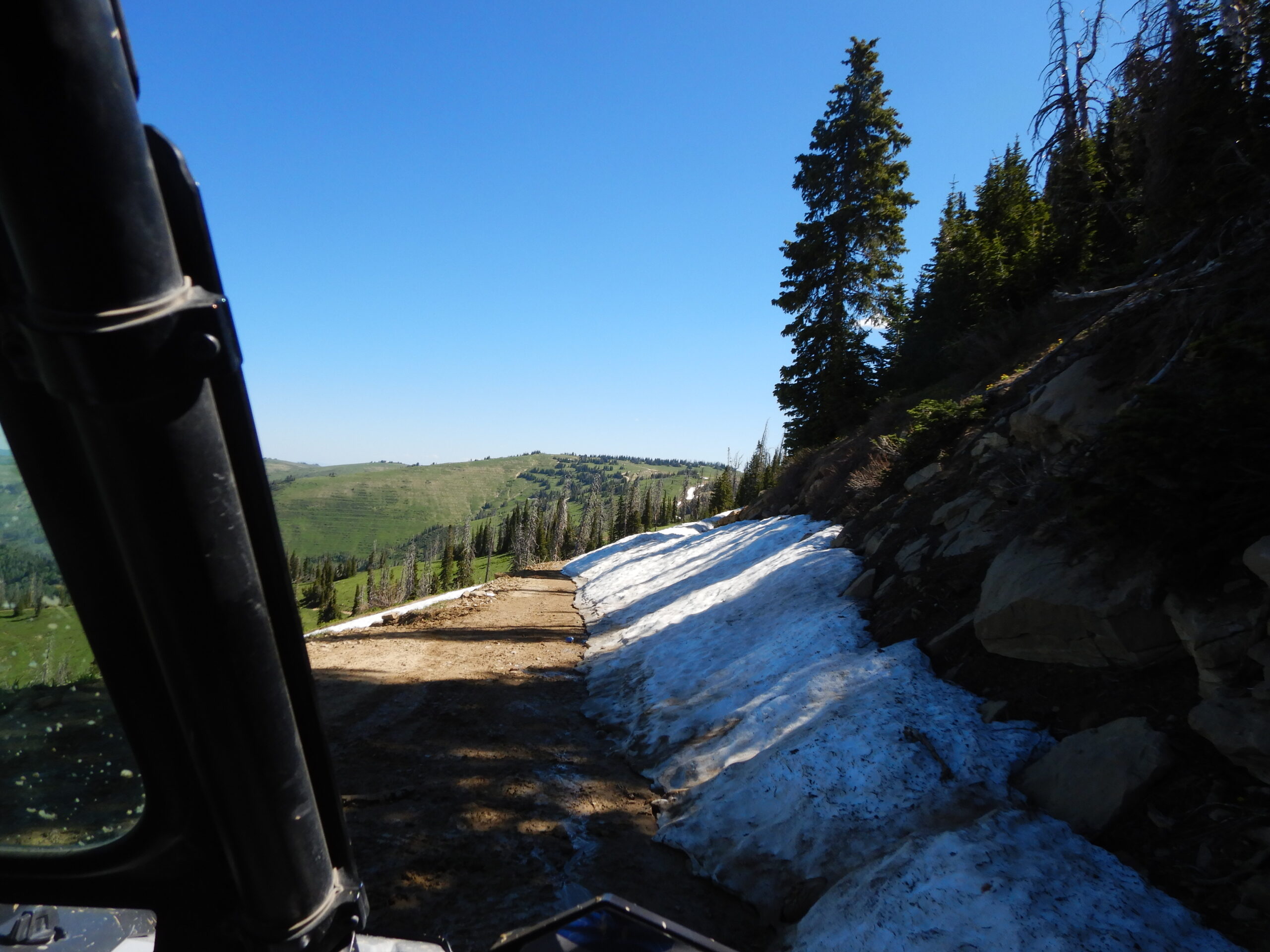
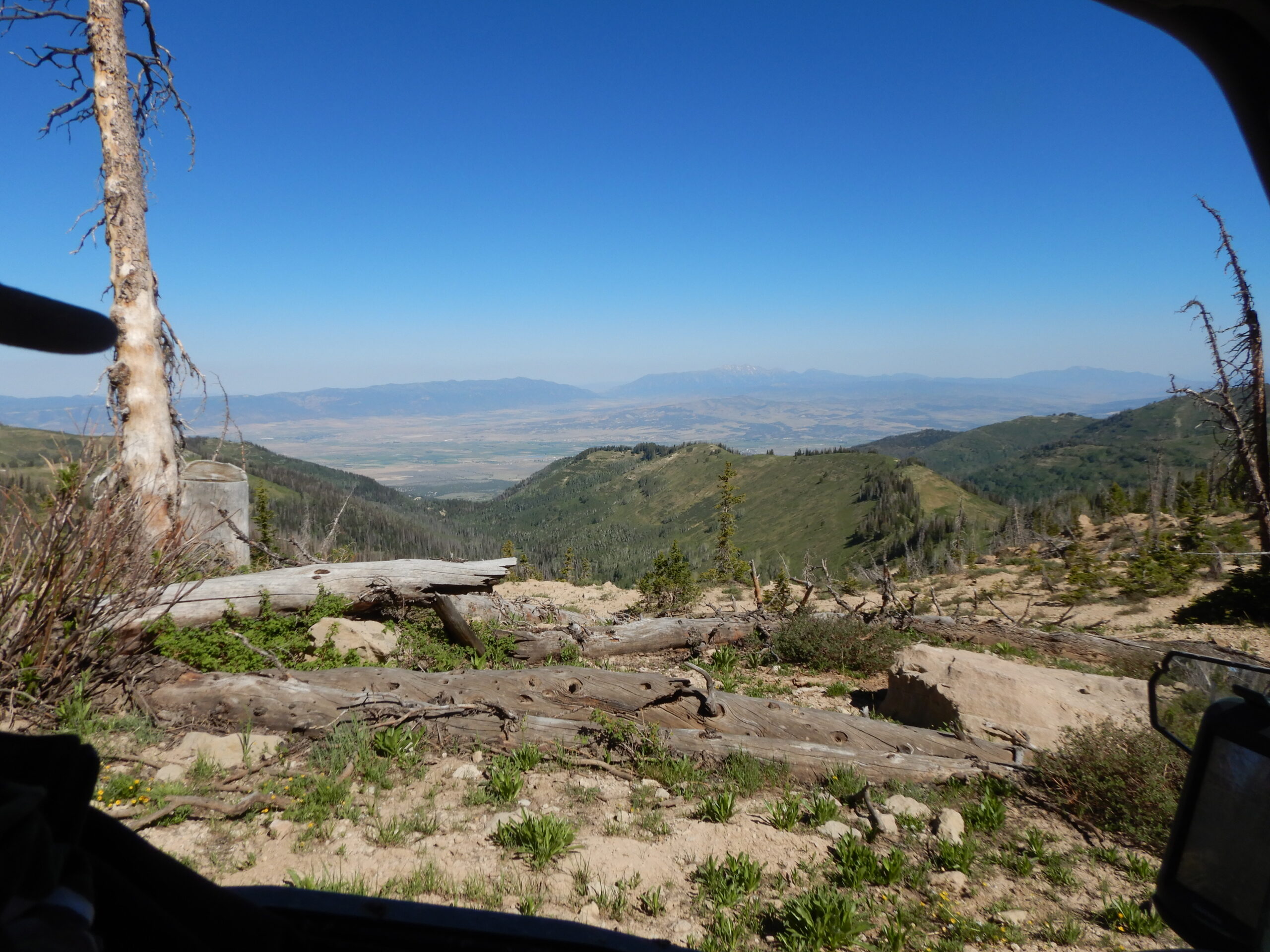
Traveling north, we were riding on a ridge that presented one remarkable view after another. Passing Bacon Rind Ridge, we encountered our first problem. I had been worried about snowbanks on the trail riding this early in the season, but we hadn’t come up against anything that didn’t have a legitimate solution. This time the snowbank covered the entire trail and there was no way around it.
I looked at the map and realized that there was a solution. Turning around, we headed east down Potter’s Canyon on a trail by the same name.
Coming down to Miller’s Flat Road, we turned back north passing many good fishing holes. We finally came out on Highway31 between Cleveland and Huntington Reservoirs. Traveling west on the highway, we passed the entrance to the South Skyline where we would have come out if the trail had been open.
Turning off the highway, we picked up the North Skyline Trail. This took us down along Poison Ridge to Highway 6 where the old Tucker Rest Area used to be. Needing gas, we turned right to go up to the
filling station at the top of Soldier Summit.
Here we learned that the Polaris 800 with the belt problem was acting up again. It took a while, but checking the oil level, it was down almost a quart.
That was a simple fix and we were back on the trail. We followed the Left Fork of the White River. After passing Boiler Canyon, we found a shady grove of aspen at about 9,200 feet – a great place to stop for lunch before heading into real trouble.
Coming to the boundary of the Uinta Ouray Indian Reservation, I had been following a GPS track for three and a half days – it was a great plan that was working well. At the edge of the reservation, the road was closed and under construction.
Now what? There were no other trails – this was it. Continuing to follow our track, we went around the barrier. That is when the unthinkable happened. The GPS track turned up Indian Canyon, but there was not even a hint of a trail that way. The only thing that I could figure was that construction on the road obliterated the trail.
We decided to continue on the closed road, hoping to meet anyone who could help. Well, that is exactly what happened. A supervisor stopped us and told us it was illegal to be on the road and that had he been a Forest Service Ranger, he would have cited us.
After explaining our dilemma, he proved helpful. Taking his direction to the end of the construction, we joined a blacktop road leading away from the Soldier Creek Reservoir.
Traveling northeast, we came to a trail marker with the #10. It was going in the right direction so we took it. It was the right decision – we were back on the GPS track we were trying to follow.
It was the narrow two-track trail on Strawberry Ridge that I remembered it to be. Some of the climbs were very steep causing drama at the end of the line. Claudia Thomas was the driver in Fred Newton’s four-place Polaris. She had no experience with climbing steep trails so Fred was coaching from the passenger seat. It was more like yelling, “Don’t take your foot off the gas. Keep going!” She did and now she thinks she can handle anything.
Dropping down off Strawberry Ridge, the trail took us to the lodge at Daniel’s Summit completing a ride of 149 miles. We had missed dinner at the lodge restaurant by ten minutes so we bribed a pizza guy to bring dinner from Heber City. When you go, take plenty of water, keep the rubber side down, and if you can’t find any solutions, you have a problem.
Day 5
This big ride from Kanab to Kamas had all come down to this final day. The weather had been great and nothing indicated that was going to change. The machines were all working well and everyone was in high spirits. The night before we had arrived at the lodge after the restaurant had closed. We left in the morning before it opened, but it was okay because the horse had seen the barn, so to speak, and we were excited about getting to Kamas.
I was facing this day with some trepidation. I had GPS tracks for all the previous legs of this trip, but for some reason, I could not find the track I had made when I rode the trail between Daniel’s Summit and Soapstone on Highway 150. So I was going completely from memory. I was leading the ride with six machines following me. I figured that it wouldn’t make anyone’s day to say that I was ignorant of this thing. So I acted like I knew where I was going and they followed.
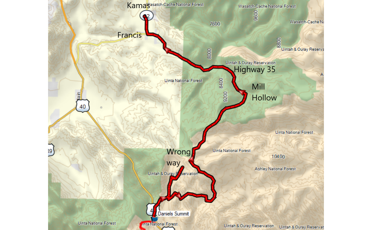
Leaving the lodge, we turned north on Highway 40. If you have ever come over Daniel’s Summit from Strawberry Reservoir on the way to Heber, just across from the Lodge Pole Campground is a trail that looks like it takes off the highway at a 45-degree angle. That is the trail we took and in only a few minutes, we were back in the beauty of the Uinta National Forest.
The trail turned northeast and we soon found ourselves in a primitive campground at a junction. This was all familiar and my confidence in the trail waxed strong.
At the junction, I turned north because it made sense. Coming to Mill B Flat, we found some lone campers. No, the mill wasn’t flat, that is just its name.
Not being above asking directions, I stopped to ask them if this trail would take us to Kamas. As it turned out, they had no idea where they were, it just looked like a good place to camp.
Moving on, we were riding at an altitude of over 9,000 feet. The scenery was picturesque and peaceful. We were riding in a cool breeze – life was good except none of this looked familiar. I followed my nose into a dead-end, but I seemed to be the only one concerned about it.
Turning back, we continued on the trail. Things were going well until I realized that the trail had turned south. It was not the direction I wanted to go and the track seemed to be fading. I called a halt to our little wagon train and we turned around – retracing our track.
Passing the campers at Mill B Flat, I didn’t wave hoping they wouldn’t notice that we were the ones who had asked directions. We soon found ourselves back at the original campground where we had turned north.
This time we went south. The trail soon turned back to the north and something in the deep dark canyons of my mind registered this as familiar. It was a fast road and we were able to make a good time.
I stopped one more time for directions and found that this track would take us to highway 35. We came out onto the highway at Mill Hollow and turned west.
Passing through Francis, we turned north and arrived at the Kamas Food Town where we found our trailers waiting for us to load our machines ending the ride. We had arranged with friends to get our vehicles from Kanab to Kamas and by the time we arrived, we were very grateful for what they had done for us.
We gathered for a group picture. It was easy to see on their faces that what we had done was quite an accomplishment. When you go through so much together, bonds are made and those bind friends together in lasting relationships.
We spent five days together working through challenges on the trail – breakdowns, blocked trails, and finding our way when the trail didn’t seem to be going the right direction. It was a great adventure that will not soon be forgotten.
Our ride totaled 543 miles through some of the most amazing parts of the country I have ever seen. When you go, take plenty of water, keep the rubber side down, and learn where to go in Utah’s beautiful backcountry.


